
Related Stories
Island in the Sky
Entombed by ice, lost souls and legendary allure, the Cascades’ greatest peak has defined the Pacific Northwest’s…
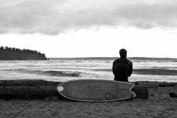
Surfing Vancouver
For Vancouver surfers, finding waves usually means a flight, a ferry or a dash south to Washington. But every so often…
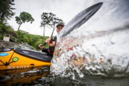
Meet The Youngest Person to Solo Paddle Around Vancouver Island
Seventeen-year-old Finn Steiner has just completed a solo circumnavigation of Vancouver Island via kayak making him the…

Slocan Paraglider Flies From Vancouver to Calgary
Benjamin Jordan is the first paraglider to journey from Vancouver to Calgary, Pacific to prairie, over the mountains of…